A Mobile Application to Secure Land Tenure
Blog Post

Gilles Paire, Shutterstock.
Aug. 3, 2017
The Future of Property Rights initiative believes that property rights matter and that technology can play a critical role in helping countries accelerate the pace of property rights formalization while simultaneously reducing costs.
We analyze multiple technologies, looking at the tools that are currently in use, the established technologies that could replace them, and the emerging technologies we believe will be used in the future. We are in the process of doing this for each essential task -- from mapping to database management -- required for property rights formalization and land administration.
For the task of demarcating informal lands, for example, the prevalent solution is to contract professional surveyors who use expensive tools. A widely available and more cost effective technology which could be used instead is a GPS-enabled smartphone coupled with cloud-based data processing, and the technology we can see improving land demarcation in the immediate future is dual-band GPS, paired with either smartphones or drones to create ortho-maps.
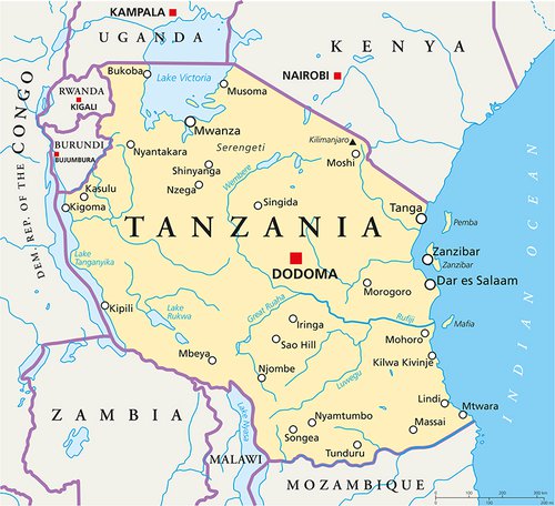
Cadasta illustrates the inadequacy of professional surveying for property formalization in emerging economies with a compelling infographic. They argue that given the scarcity of professional surveyors in the developing world, “documenting land rights through traditional methods [surveying] will take generations.” In Uganda, for example, they estimate that it would take the country's “few dozen” surveyors a millennium to survey the “estimated 15 million parcels of unregistered land.” They go on to point out that Tanzania only has 1.9 surveyors per 10,000 square kilometers compared to 26 in Norway, and 41 in America. It is fair to assume that wealthy, developed countries like Norway and the USA have significantly less informal land. So how can countries like Uganda catch up?
There’s an app for that
As smartphones have become ubiquitous over the last decade, an ecosystem of mobile data collection apps has emerged, making the prospect of cheap, crowdsourced data collection more feasible than ever before. Most of these apps have been aimed at users in the developed world, where the use cases impose very different cost and accessibility requirements. An app that only runs on a late-model iPhone, for example, would be unsuitable for community mapping in the developing world no matter its functionality.
In her 2016 Master’s thesis An app for land administration: criteria, functional requirements and a prototype in Ethiopia [PDF], Julinda Dyil of the University of Twente examined 30 of these apps for their suitability for community mapping. The two fundamental requirements she identified were that the apps must be “designed to support poor people and communities” (pro-poor) and “designed to support management of land administration systems” (fit-for-use). Dyli breaks these two requirements down into sixteen criteria. Many of these overlap, and for the sake of simplicity we will distill them them down to four broad criteria:
1) Affordability
The app must be free or very inexpensive. If the purchase price or subscription fee is high, or if the app can only be run on an expensive phone, then it will not be suitable for community mapping.
2) Accessibility
The app must be simple and intuitive to use for people with limited education and literacy. If it is too complex to operate it will not fit into the sort of collaborative, inclusive methodology that is best able to guarantee fairness and transparency. The geospatial data cannot be abstract; it must be tied to a map that shows people what it corresponds to on the ground. The data produced must be in format that is easily shared and read by the different parties involved.
3) Adaptability
Different regions and jurisdictions have different requirements for land and tenure attribute information as well as GPS accuracy. The app must therefore be flexible in its ability to collect both kinds of data. It must be able to collect complex usage and tenure information across the continuum of rights. The app must include forms to enter attribute data, ideally ones that can be customized without programming. Compatibility with external GPS receivers is also important for simple adaptation to regional accuracy standards.
4) Accuracy
The integrity of the information collected must be high so that everyone involved in the process, from the landholder to the government land agency, has trust in the data. The accuracy of the GPS data should be high enough to satisfy legal standards in the area where the mapping takes place, but no higher if increased accuracy will impose greater costs.
Apps designed with these criteria in mind are already being used to record property rights, notably by USAID’s Mobile Application to Secure Tenure (MAST) program.
USAID - MAST
MAST is an approach that includes a participatory process for land documentation and a suite of open source applications customizable fors GPS-enabled smartphones and tablets. After a brief training, villagers can use the app to “map the boundaries of their land and gather the demographic and tenure information that government officials can then use to issue formal land rights documents.”
MAST is designed to address the social, logistical, and legal challenges of property rights formalization, not just the technical ones. At the highest level, MAST’s strategy is to engage citizens in the work of mapping, freeing up government personnel to focus on validating and registering land claims.This process starts with education and capacity building, efforts which are required to build trust in the process among everyone involved, from landholders skeptical of the value of the program to government officials skeptical of the value of community mapping. Special attention is paid to women and other vulnerable groups, ensuring they understand their rights and are empowered to exercise them.
Local committees are formed to represent the interests of customary landholders. Any disagreements that arise, such as boundary overlaps, are reviewed by these committees before being validated by government land officials. USAID does not pass judgment on contested land claims, deferring instead to local authorities.
Landholders and their neighbors walk the boundaries of their lands and overlay the collected data onto a satellite map. In addition to capturing geospatial data, MAST allows users to record the names and photographs of landholders and document various types of property rights arrangements, such as joint holdings between a wife and husband. Critically, MAST allows data to be collected offline and uploaded to the cloud when 3G or wifi service becomes available. Without this feature it would be useless in many of the rural areas where it is most needed. Once all parties, including community, government, and traditional authorities, have agreed on the accuracy of the maps and attribute data, they upload it to the cloud, where it can be accessed by land officials through a web application to be cleaned and validated. By making the data and registration requests available through a browser-based platform, MAST eliminates the need to send it by mail, cutting out a major source of latency in the registration process. After processing, a cadastral map can be rendered in jurisdictions where they are used. In Burkina Faso it took 3 Rural Land Service officers less than two months to complete this process for 2,638 parcels, with each verification taking about 30 minutes [PDF] - a dramatic increase over previous methods
MAST has for the most part been used to issue occupancy certificates, which recognize customary land rights. The rights afforded by these documents vary substantially, and may be communal or individual, depending on the jurisdiction.
In Tanzania, documents called Certificates of Customary Right of Occupancy (CCRO - PDF) are issued. These are not statutory freehold titles, but they can be issued to individuals as well as communities.
Burkina Faso issues a document called a Rural Land Certificate of Possession (APFR). Like CCROs, these can be issued to individuals, and occupy a middle ground between statutory and customary land rights.
The certificates issued in Zambia, by contrast, were both communal and customary. These certified the landholders right to occupy part of a greater, communally-owned parcel, such as a village.
MAST was piloted in Tanzania in 2014 and later scaled up as part of a larger Feed the Future program, rolled out in Zambia in the same year, and brought to Burkina Faso in 2016. A detailed summary of the results in each country follows, but what is most significant is that MAST was able to use smartphones, a widely available technology, to crowdsource data collection, bypassing the professional surveying bottleneck.
MAST in Tanzania
MAST debuted in Tanzania, where the government and USAID recognized that the lack of registered land was having a negative impact on the business climate, ecology, and social institutions of the country. The $1 million initiative --originally called the Mobile Technology Pilot and renamed MAST-- ran from 2014 to 2016 and was a successful proof of the crowd-sourced formalization concept, mapping land quickly with low-cost mobile technology.
Laying the groundwork for the project, the village government organized educational councils and committees to teach the community the basic land laws of Tanzania, as well as the technical and procedural details of MAST’s operation. The village government also established a special council of land dispute resolution.Groups of young people were trained to be the project’s data collectors, known as trusted intermediaries. Women were allotted half of the seats on the council, which performed the critical task of ruling on arguments between landholders.
This measure was intended to safeguard the property rights of women. Women are afforded equal property rights under national law, but are often denied these rights because of customary norms. This proved to be a successful strategy; women became proprietors of 50 percent of the newly mapped land.
The expanded MAST program resulted in CCROs being issued quickly and at low cost. The villagers were able to map nearly 1,000 parcels in under three weeks, though it took several months for the District Land Office to issue the CCROs.
MAST in Zambia

In 2014 MAST expanded into Zambia, where there was widespread public demand for more secure property rights. One survey conducted in rural Zambia found that 91 percent of respondents “stated a desire to acquire some form of paper documentation for their land.” According to a 2015 USAID publication, 26 percent of rural households In Zambia’s Eastern Province reported having experienced “at least one land conflict in the past three years, with the vast majority [being] over boundaries or inheritance.”
According to a Devex article on climate-smart agriculture and tenure in Zambia, this pervasive lack of formal property rights had consequences beyond the frequent land disputes: it discouraged farmers in one of Africa’s most fertile countries from investing in their own land to increase food crop yields. Zambians needed to farm more sustainably, for example by planting nitrogen-fixing fertilizer trees to improve crop yields, but were afraid to do so because of the lack of formal property boundaries.
The land laws in Zambia introduced new complications for MAST. The land system in Zambia is split into parallel statutory and customary systems which have very little interaction with one another. The customary system is informal and undocumented...while the state system is largely absent in these rural areas. In addition, the process of converting customary land to state land is irreversible under national law, which has created islands of long-abandoned but technically statutory land. According to a 2017 paper [PDF] presented at the World Bank Conference on Land and Poverty, this includes “hundreds of hectares of pre-colonial farms which technically rest in the state system yet have been inhabited exclusively for decades by local communities.” This introduced a risk of formalization efforts exposing customary landholders to these latent statutory claims.
An important methodological development in Zambia was the introduction of a randomized control trial evaluation to measure the program’s effectiveness. The mapping process was otherwise similar to the one in Tanzania. It was implemented in 150 villages by a team of less than 50 people with less than 3 weeks training. The program issued over 6,000 customary land certificates, one quarter of which were issued to women.
USAID, in partnership with Tetra Tech, Terra Firma, and the Petauke District Land Alliance, is also engaged in a follow-up activity in which MAST would be brought to a larger customary territory with a diverse set of resource management challenges to be tested for scalability.
MAST in Burkina Faso

Burkina Faso’s USAID MAST pilot, which began in late 2016, required a customization of the MAST-Tanzania approach and applications in order to meet the requirements of a major land reform law passed in Burkina Faso in 2009. The law was enacted in response to “pervasive and increasingly violent” land conflict, driven by a variety of factors including migration, drought, and rising demand for natural resources. The land law it replaced, the Agricultural and Land Tenure Reform law of 1984, sought to bring all customary lands under the centralized control of the national government. Though it was intended to bolster development, that law has itself been cited as a major driver of land conflict. The intent of the 2009 law was to replace this system with a more decentralized and inclusive one which would formalize customary land rights instead of excluding them from the statutory system as the old law had done. The recognition of customary rights was seen as key to ensuring equal access to agricultural land, promoting investment and productivity, reducing conflict, and promoting more sustainable resource management.
To this end, the law created a system of rural land departments and village land commissions, to be responsible for land registration and management. The law also called for the technical departments of the state government to provide management and capacity building assistance to the rural land departments, and established a national fund to finance these activities.
Also introduced was a 3 meter accuracy requirement for rural land surveying, which necessitated the addition of external GPS receivers to the USAID MAST platform. The unit selected, the Bad Elf GPS Pro, cost about $200 per unit in Burkina Faso. These receivers were paired to the mappers’ phones by bluetooth and powered by external batteries. Including the 32GB android phone, the total cost of each handheld data collector was $720, still a substantial reduction in cost compared to the $3,000 sub-meter GPS unit used by the government topographer in the previous survey system. Other changes to the original mobile app, data model, workflows and server application, were required, including the translation of the app into French.
As in Tanzania and Zambia, the result [PDF] was a dramatic increase in the pace of mapping compared to the traditional system MAST replaced. It took less than two weeks for a dozen data collectors to map nearly 2,700 parcels. Between October 2016 and February 2017, they were able to prepare 2,638 land claims in single commune, compared to 3,706 prepared by the old mapping method in 47 communes from 2013 to 2016.
The Future of MAST
In early 2017, USAID launched a new program -- called Land Technology Solutions -- to expand its successful Mobile Applications to Secure Tenure (MAST) initiative, designed to refine MAST and support its expansion into new countries.
For now, MAST is only used in rural areas. This is due in part to high need in these areas, though MAST and similar crowdsourced mapping programs are also limited by urban accuracy requirements, which cannot be easily met with the type of GPS (single-frequency) currently available in cell phones and affordable external receivers.
Within the next five-to-ten years this limitation may be removed by the availability of affordable dual-frequency GPS units capable of centimeter precision in urban environments. In addition to being very precise, dual-frequency GPS is easier to operate in cities, where there is more interference and lower signal availability. This give us hope that the MAST concept can be extended to the African urban setting, where there is a pressing --and growing-- need for it.
Globally, 54% of the world's population is already urban. In Africa, according to a February 2017 World Bank report entitled Africa’s Cities: Opening Doors to the World, the urban population is expected to double over the next 25 years. This growth is making Africa’s cities increasingly critical to their countries’ economic development, but it is at risk of being derailed by unclear property rights. If this growth is to be protected, the report concludes, the first priority is to formalize land markets, clarify property rights, and institute effective urban planning that allows land to be brought together.
For more on GPS, see our articles on dual-frequency GPS and surveying and the forces driving the falling price of dual-frequency hardware.