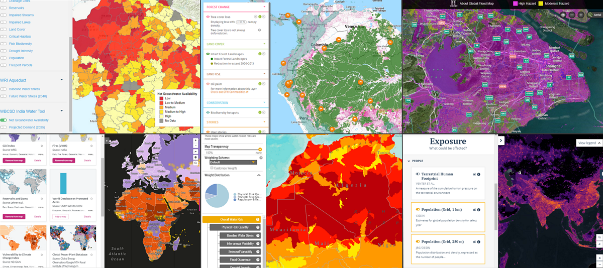
Risk Assessment Tools
Quantitative and qualitative judgments of risk
Most of these tools are multi-dimensional, looking on one side at plausible hazards and on the flip side at a country’s ability to respond or adapt to those hazards (note that “risk assessment” can refer to a scientific process with technical specifications in a number of fields. In this case, the tools in this category are generally using a broad definition of “risk assessment”). A third axis is that of time, which measures whether risk is increasing or decreasing. For example, Notre Dame’s Global Adaptation Initiative (ND-GAIN) ranks countries by vulnerability and readiness over 20+ years. Risk assessments focus on current conditions and are typically updated annually, though most have data going back ten or more years. Risk assessments are similar to indices in that they often assign a relative score and ranking to a country and the annual updating of these assessments can spur media interest and raise awareness on the risks countries face.
| Tool Name | Climate Change | Conflict and State Instability | Natural Resource Drivers |
|---|---|---|---|
| Index for Risk Management | ✔ | ✔ | |
| Climate Change and African Political Stability | ✔ | ✔ | |
| Global Flood Map | ✔ | ||
| Fragile Cities | ✔ | ✔ | |
| Notre Dame Global Adaptation Initiative | ✔ | ✔ | ✔ |
| Drivers of Vulnerability Monitor | ✔ | ✔ | |
| Early Warning Project | ✔ |
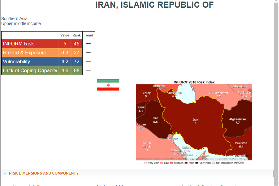
Index for Risk Management (INFORM)
Inter-Agency Standing Committee (IASC) Task Team for Preparedness and Resilience, the European Commission, and others 1
An open-source risk assessment for humanitarian crises and disasters.
The vulnerability rankings are based on 50 indicators across three dimensions of risk: hazards & exposure, vulnerability, and lack of coping capacity.
Visit the tool here: www.inform-index.org
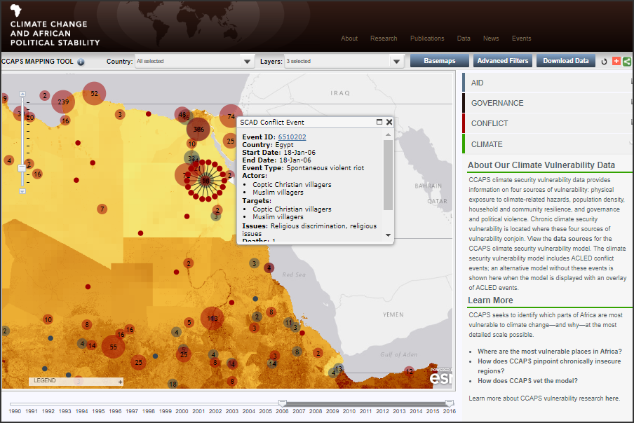
Climate Change and African Political Stability (CCAPS)
Strauss Center at the University of Texas at Austin 2
A mapped display of information on four sources of vulnerability across Africa: physical exposure to climate-related hazards, population density, household and community resilience, and governance and political violence.
The data represented is from 2006 to 2016.
Visit the tool here: ccaps.developmentgateway.org
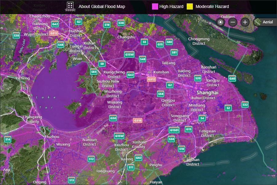
Global Flood Map
FM Global 3
An initial flood assessment tool, based on data and hydrologic models, that identifies areas in high and moderate risk flood zones.
Visit the tool here: www.fmglobal.com/research-and-resources/global-flood-map/flood-map
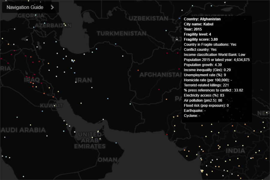
Fragile Cities
Igarape Institute 4 in collaboration with United Nations University, World Economic Forum, and 100 Resilient Cities
A data visualization tool that tracks the distribution and evolution of fragility risk in at least 2,100 cities worldwide since 2000. It features a composite score of city fragility that combines multiple metrics, such as urbanization, inequality, concentrated poverty, youth unemployment, justice deficits, real and perceived insecurity, and natural hazard exposure.
Visit the tool here: fragilecities.igarape.org.br

Notre Dame Global Adaptation Initiative (ND-GAIN)
University of Notre Dame 5
A country-level ranking system that captures a country’s vulnerability to climate change and other global challenges , and its readiness to improve resilience. It is updated annually.
Visit the tool here: gain.nd.edu

Drivers of Vulnerability Monitor
Hague Center for Strategic Studies (HCSS) 6
A global map that displays 50 security, economic, social, political, and geographic drivers of state vulnerability to intrastate conflict. It also tracks the change in each country’s vulnerability from 1992 to 2014.
Visit the tool here: projects.hcss.nl/monitor/86
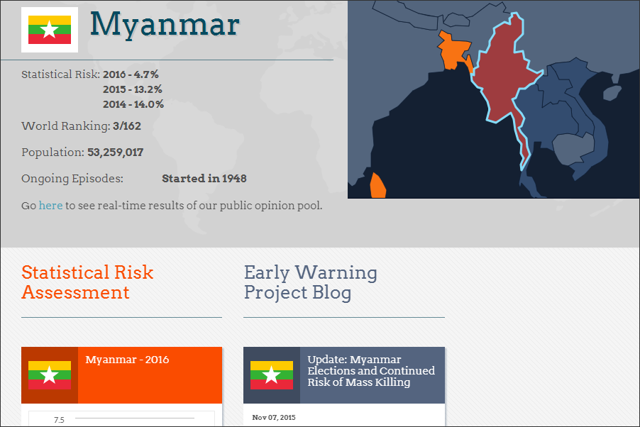
Early Warning Project
Simon-Skjodt Center for the Prevention of Genocide at the United States Holocaust Memorial Museum 7
A tool that estimates whether a country will be susceptible to an onset of state-led mass killing in the next year.
The assessments come from the average of three statistical models that represent key perspectives on how best to anticipate when mass killing will occur. These quantitative models are supplemented with crowd-sourced expert opinions.
Visit the tool here: www.earlywarningproject.com
Citations
- A UN organization that coordinates among UN and other international humanitarian groups.
- A public university research collaboration funded by the U.S. Department of Defense.
- A U.S.-based property insurance company.
- A Brazil-based independent research organization funded by governments, foundations, NGOs, and individuals.
- A private U.S.-based university.
- An independent Netherlands-based research organization, funded by governments, foundations, and NGOs.
- An independent U.S.-based museum, funded by the U.S. government and private donations.