President Theodore Roosevelt was fond of the saying “nine-tenths of wisdom is being wise on time.” Today, new technologies may afford national security and humanitarian experts and practitioners more ways to be “wise on time” when it comes to forecasting armed conflict. In particular, it may be possible to anticipate conflict from space.
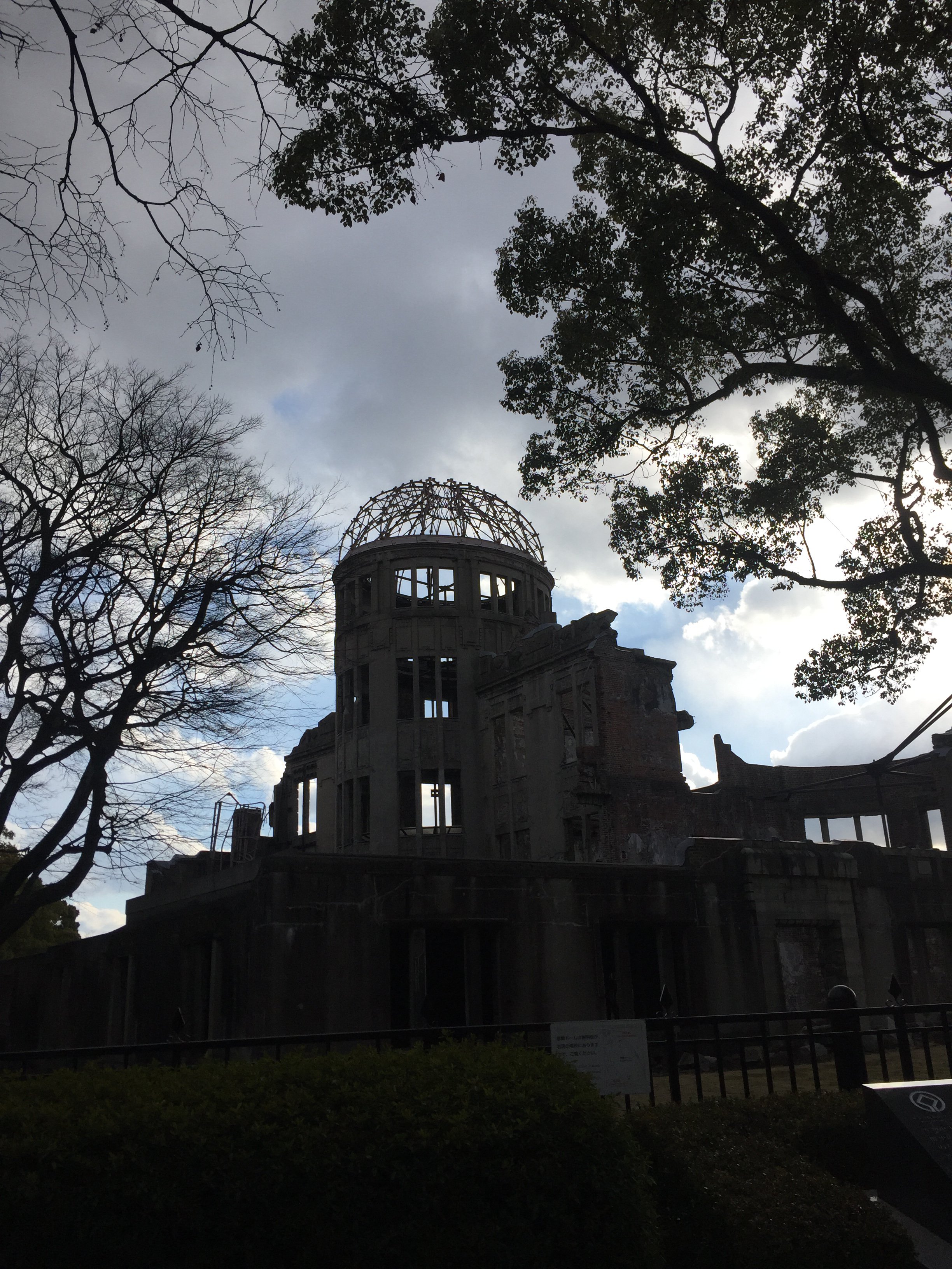
We know, at the very least, that it is possible to monitor conflicts from orbit. The Satellite Sentinel Project, for example, used satellite imagery from DigitalGlobe to accumulate evidence of imminent mass violence, razed villages, and mass graves in Sudan from 2010 to 2015. While that project received significant media attention due the fact that celebrity actor George Clooney was a co-founder, it is far from the only humanitarian watchdog with eyes in the sky. Amnesty International and Human Rights Watch have both increased their use of satellite imagery in recent years, as have the United States Holocaust Memorial Museum, the World Bank, and other projects.
Innovations in the private sector and academia have expanded the capacity of these non-governmental actors to carry out such high-end (so to speak) monitoring activities; in particular, the automated detection of objects in imagery has garnered significant interest. The company Planet, for example, has developed machine learning to monitor the movements of maritime vessels and aircraft, as well as development of roads and other infrastructure. Software developer SpaceKnow has additional analytics on movements of cars, trucks, and shipping containers, while researchers at the University of Minnesota have begun to assess the nature of buildings in refugee camps based on roof shape and material.
New technologies have already proven to be valuable for these sorts of monitoring and watchdog activities, but it is an open question how such innovations might help prevent violence, atrocities, and conflict. One promising possibility is remote sensing. The term “remote sensing” is primarily used to describe the deployment of aircraft, drones, or satellites equipped with sensor technologies to detect and classify objects on or in Earth’s surface, oceans, and even atmosphere. Recent technical advancements, such as an increase in commercially available resolution up to 30 centimeters per pixel, lower-cost satellites, new machine learning techniques, and low-cost cloud computing, have lead to a boom in the availability and quality of remote sensing data.
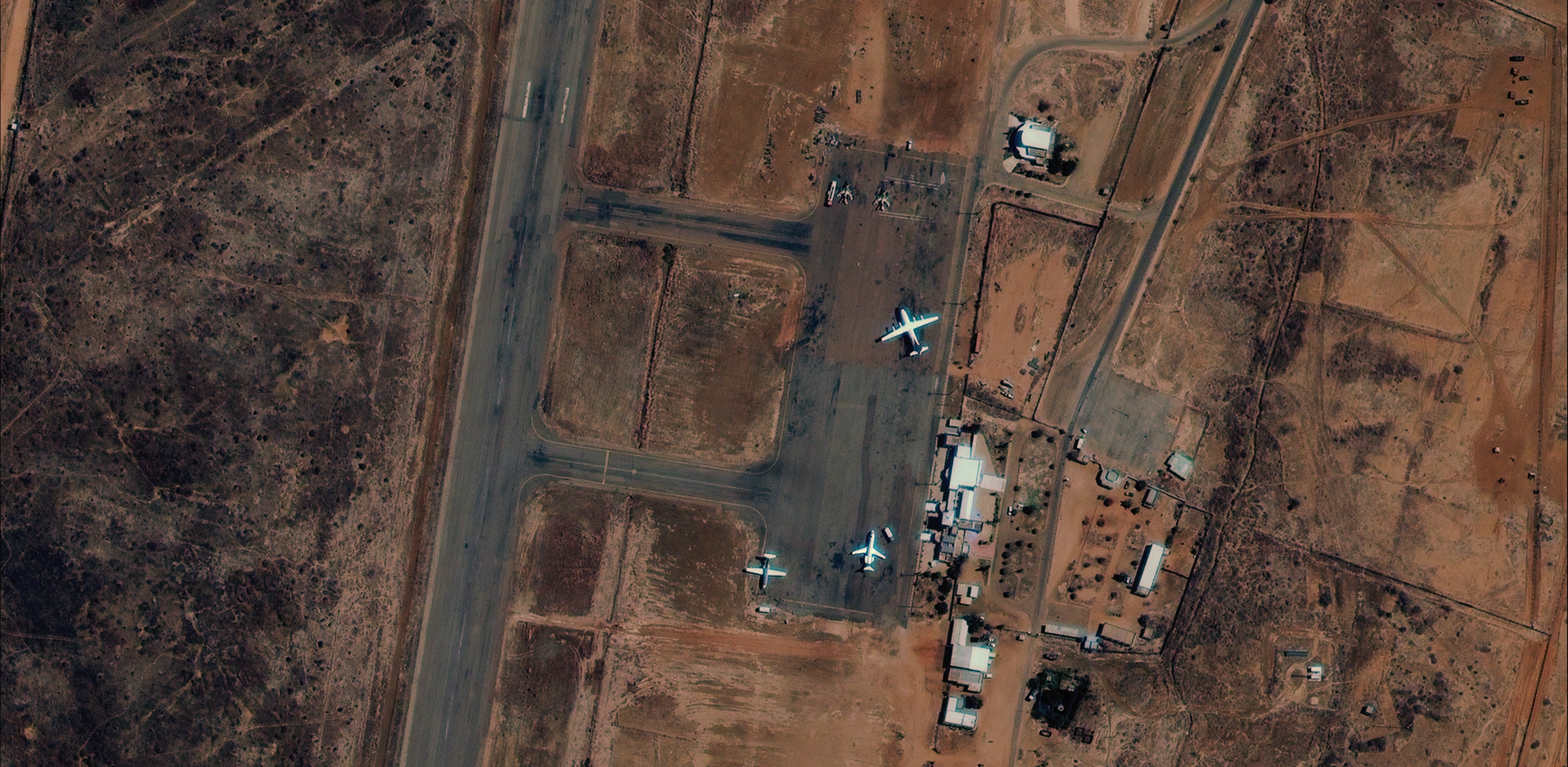
Satellite imagery, which has proven so powerful for monitoring conflict, may be of particular interest. Satellites are currently one of the most powerful sources of data for large-scope analysis of physical conditions on Earth due to the data’s portability, frequency, and scale, as well as the wide variety of resolutions available for different purposes. Most importantly, satellites can acquire data in places where in-person collection is infeasible, which can be the case for conflict-prone areas. Of course, the existence of satellite imagery is nothing new, but until recently, most publicly-available satellite data was sourced from government agencies and not available to non-governmental users, and it did not possess the resolution and analytical algorithms currently available to civilians. As this imagery has become commercially available, the private sector is an increasingly important source for both satellite data acquisition and analysis of satellite imagery. Between 2016 and 2017, for example, the number of Earth observation satellites grew by 66% percent.
This rapid growth in the private sector comes at a time when the defense and geointelligence sectors are transitioning towards using big data and machine learning approaches to forecasting armed conflict, moving away from the primarily statistical regression models common at the beginning of the 21st century. In other words, private sector activity is coinciding with government interest, resulting in an increase in funding for and attention to novel applications of remote sensing as it pertains to security. At a recent geointelligence convention, for example, presenters from the defense sector stressed the need for data sources that are portable, scalable, usable in layers, and provide opportunities to integrate qualitative expert knowledge into models. In other words, data has to be usable on different platforms, comparable across geographic contexts, capable of combining with other kinds of location-referenced data, and open to ground-truthing by those with specific local knowledge. These are qualities that much remote sensing data naturally has, making it a good fit for defense purposes. This is reflected by the fact that in 2017, 35% of the Earth observation market was classified as for“defense application."
Yet so far, government and non-government organizations do not widely use satellite data as a primary data input for conflict forecasting models. This is, in part, due to the inherent difficulty of forecasting conflict events, and in part due to the nature of remote sensing. Armed conflict is a product of human action, and post-conflict identification of the root causes of conflict often reveals factors that did not seem germane in the lead-up. Remote sensing is, on its own, only able to capture the physical impacts of human action. While some actions that can be signals of conflict intent — such as troop movements, the sudden growth of refugee camps, or road construction near military bases — are observable, they often occur at a timescale too short to “predict” the conflict in any meaningful way. On a longer timescale, Earth observation and recently developed image detection algorithms may be able to measure “Phase Zero” conditions, or conditions that may be a precursor to violence, instability, and conflict, such as poverty, environmental challenges, illicit funds, and shifting social attitudes (how positively a population regards such factors as government, the economy, and quality of life).
Poverty
A region’s poverty index, previously measured through proxies such as infant mortality, can be associated with an increase in instability and conflict potential. Recent studies combining disparate data sources have shown statistical significance linking night light, vegetation, and building materials (all identifiable by spectral signatures) to the level of poverty in a region. Not only is this more efficient and scalable than the traditional gold standard for poverty estimation (intensive household surveys), but it is usable at small administrative units.
Environmental Challenges
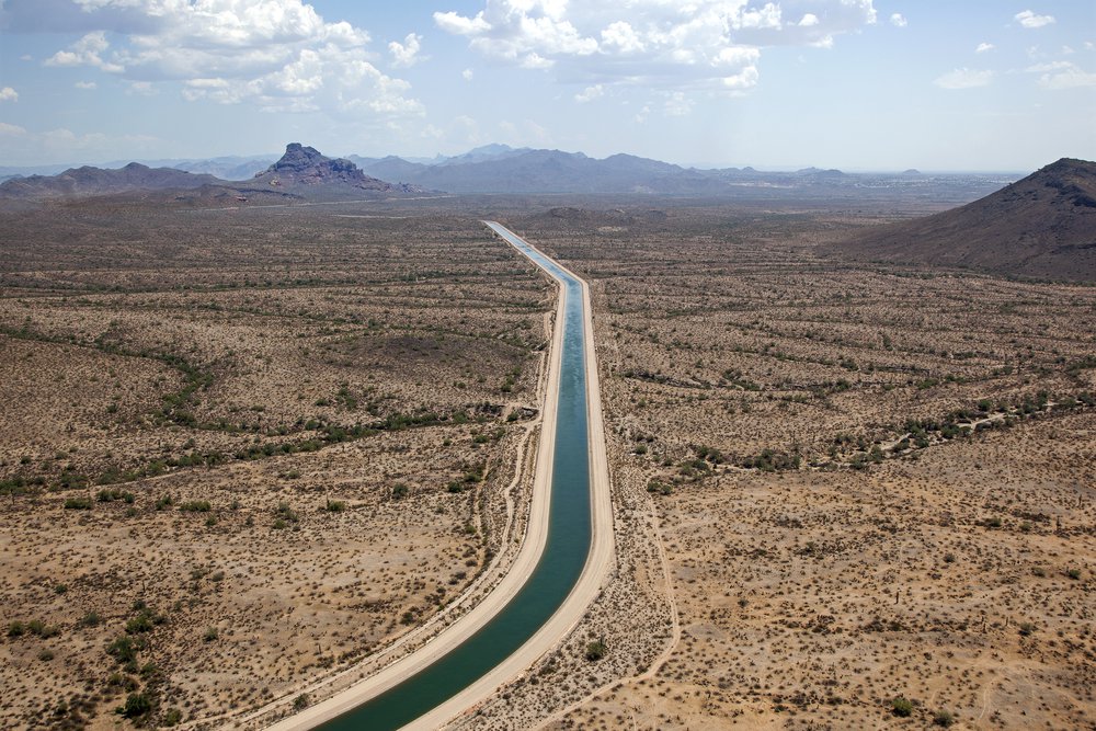
Although much of the scholarship on the relationship between environmental challenges and conflict contends there’s no causative relationship, other studies talk about problems such as water and food insecurity as “threat multipliers” that exacerbate underlying weaknesses and can catalyze or worsen conflicts. Several recent studies have shown a correlation between food and water insecurity and land conflict, civil unrest, and mass migration, which are themselves drivers of conflict. This suggests that food or water insecurity might be an early warning of instability, particularly relevant for neighboring countries concerned about the spillover effects of displaced people attempting to escape the shortages. Governments and non-governmental organizations could use remote sensing to detect changes in water or food availability in areas of concern. Descartes Labs, a private sector firm, has used these technologies to predict crop yields for maize in the United States, for example; a similar approach might be able to predict where and when food shortages are likely to occur. Remote sensing is also able to estimate soil saturation levels, with the potential for drought forecasting over time.
Disaster Recovery
Natural disasters and hazards, beyond imposing great human and economic costs that may spur displacement and instability, also provide an opportunity for a regime to gain or lose prestige and operational capacity given their ability to respond to post-disaster conditions. The Harvard Signal project has produced a handbook on how to use remote sensing to estimate the extent of damage on various types of buildings after a natural disaster (specifically wind damage). Analyzing a time series of buildings from destruction to recovery may give a sense of how well a government was able to respond to a crisis, which would give a sense of both the damage inflicted by the disaster and how great the resulting instability would be.
Illegal Resource Extraction
Clandestine resource extraction, such as illegal logging, gold, diamond, and oil mining, can be a key source of income for non-state actors, such as militia or violent extremist organizations. Evidence of such illegal activities, such as land cover change or deforestation in an area where there are no legitimate, approved projects, may serve as an early warning sign that criminal or insurgent groups are exploiting an area’s natural resources for financial gain.
Shifting Social Attitudes
One of the more novel approaches to remote sensing has been to use physical features for proxies of sociocultural attitudes, some of which, such as views of economic well-being or competency of governments, may indicate conflict vulnerability. A recent study used survey data from the Afrobarometer survey (a pan-african public attitude survey), and found correlations between vegetation and edge detection levels (basically tracking built infrastructure) and survey responses. The strongest links concerned infrastructure and personal economic satisfaction, although there did seem to be potential in predicting attitudes on crime, the government, and well-being. While this approach is highly contextual and is still a long way from being able to provide solid data for a machine learning input, it does represent the possibility of using remote sensing data to estimate discontent and to supplement or independently verify survey data.
Limitations and Ways Forward
In order to properly use remote sensing data in conflict forecasting, it is worth acknowledging its limitations. First and foremost, while satellite imagery is often portable (able to be used on many diverse software platforms and in different geographic contexts), many of the algorithms used to make the images useful are not, and run the risk of turning into black boxes that can make it difficult to understand the methodology used to interpret the data. Furthermore, neither users nor analysts are free from bias and false assumptions, leading to potential misinterpretation or even the abuse of remote sensing data. In the former case, this is in part due to the inability to universalize data. For example, vegetation and infrastructure with similar spectral profiles in different regions may represent entirely different physical objects. Additionally, cultural and situational differences may contribute to different patterns of behavior despite similar spectral signatures–seasonal migrations might cover up a mass exodus, or roads built to facilitate border trade might seem like developments for military purposes. This makes drawing conclusions about human behavior based on physical signs risky without local, contextual knowledge. Finally, the usefulness of satellite imagery is, at times, somewhat contradictory. While it is often employed to collect data in areas where conventional data-gathering techniques are infeasible or dangerous, many of the regional patterns identified through the analysis of satellite imagery require ground-level verification. Remote sensing data is also clearly open to abuse; a human rights organization might use imagery to provide evidence of abuses, while a more nefarious actor might find such imagery just as useful in locating targets for such abuse.
Despite these limitations, there are a few paths forward that might bring the use of Earth observations for forecasting conflict to the next level:
- Develop regional expert networks that can interpret and ground-truth high-resolution imagery for use as inputs for large-scale machine learning models.
- Further investigate using geographical features to model human attitudes, building on early successes of the Afrobarometer project.
- Use Earth observations as a way to develop a more complete understanding of the context-dependent factors that may destabilize a region, including environmental degradation, the exploitation of natural resources, and climate change.
While there is clearly potential for remote sensing data — when combined with machine learning algorithms and ground-truthing with local expert knowledge — to serve as a direct input for conflict forecasting models, it is equally clear that it will be a long and fraught path to such an outcome. It will take significantly more research into both the root causes of conflict and the indicators of these factors visible from the sky for remote sensing to move from a loose predictor to a true oracle.
More About the Authors
Issues
Programs/Projects/Initiatives
Topics
Related
The US Military’s Fuel Profligacy in Context

Ensuring Resiliency of Military Installations and Operations in Response to Climate Changes
Building Tools at the Boundary of Climate Science, Security, and Action