Table of Contents
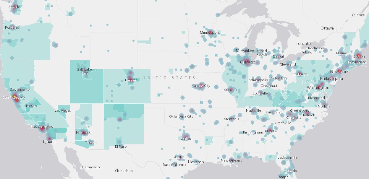
Map: Network Connectivity across American Communities (2018)
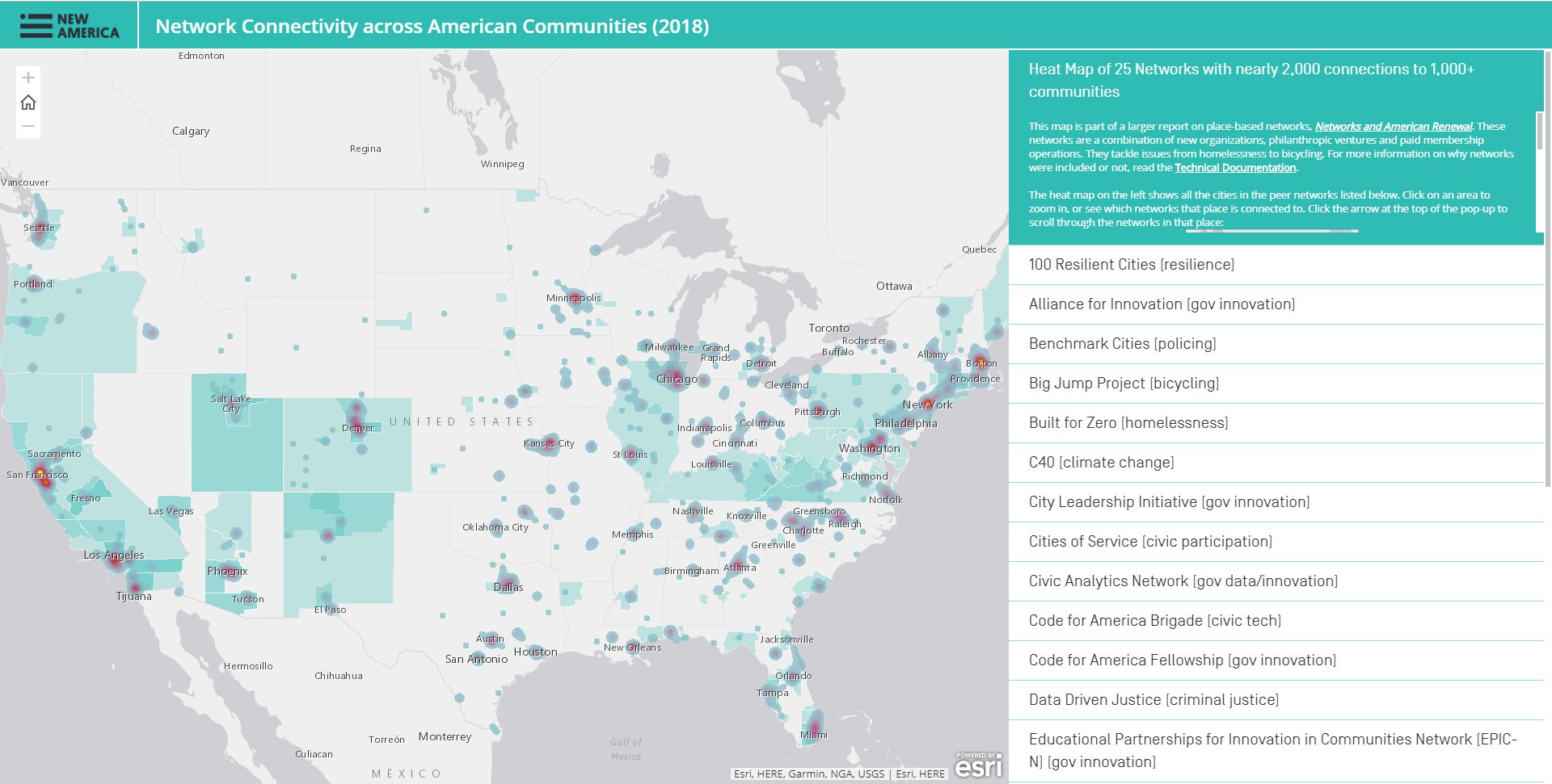
Over the past year, we examined the geographic spread of a sample of networks at work in communities. We mapped 25 networks that are helping cities and counties solve a wide-range of social challenges and collected data about networks working in over 270 U.S. metro- and micropolitan areas to advance solutions in criminal justice, climate change, open government, and economic opportunity. Use this map to:
- Zoom into a specific community to see what networks it is connected to.
- View the patterns in the heat map of which places are super-networked, and which places are not.
- Browse the 25 networks individually to see which communities are members, and learn more about what each network does, how to join, and what resources each network makes available.