Table of Contents
Introduction
Early action requires early warning. Nations and non-governmental organizations alike have long looked for ways to anticipate conflict far enough in advance to prevent or mitigate it. The field of conflict studies has made major progress toward that kind of foresight by cataloguing, analyzing, and in some cases modeling conflict events. However, this work is often limited in geographic scope, difficult to generalize (due to theoretical or practical constraints, such as data availability), or focused on a narrow range of drivers or outcomes.
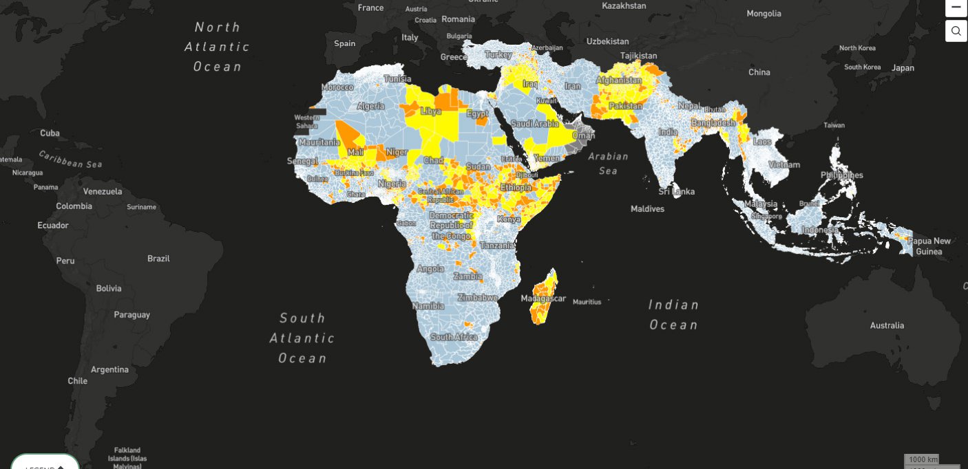
The Water, Peace and Security (WPS) partnership, a public-private collaboration sponsored by the government of the Netherlands with additional support from the Skoll Foundation, has developed a model for forecasting lethal conflict—defined here as organized political violence1—that overcomes some of the constraints. By gathering, processing, and harmonizing dozens of quantitative indicators, we created a single dataset that describes local conditions around the globe since the early 2000s. We then applied machine learning to these data to create a quantitative model that warns of conflict risk up to a year in advance.
Our work differs from existing research in a number of ways. First, it is global in scope. Second, the model makes predictions at a fairly high resolution: the second-level administrative district (equivalent to a county in most of the United States). Third, it incorporates indicators from a wide variety of domains, such as economics, demography, and health. Fourth, these inputs include novel remote sensing-based datasets that help capture the biophysical environment and its possible influence on conflict. These environmental factors, particularly water, were a point of emphasis for our research. Finally, the machine learning approach (described in detail below) means that our findings are largely uncolored by a priori assumptions. Instead, the data speak for themselves.
All of this work—not just the conflict forecasts, but also the underlying datasets and the model itself—now resides in an open-source, web-based platform, designed as a decision support tool for actors in conflict prevention, defense, diplomacy, development, humanitarian relief, and related research areas. The goals of the tool are twofold: first, to identify where the risk of conflict is high or rising, and second, to provide some insights into why the risk is high or rising. Different audiences may use the tool to investigate different questions, but its core function is to provide useful, accurate information about the location, nature, and possible drivers of potential conflicts. Although both the model and the underlying data have limitations, the tool presents a big-picture overview of emerging security situations within a coherent and consistent framework.
Furthermore, beyond the model itself, the tool provides a vehicle for the easy exploration of local or regional conditions. By examining current events and conditions alongside historical time series, users can investigate a given area and draw their own conclusions about the security situation and the pertinent factors for conflict or peace. Users can combine their own expertise and local knowledge with rigorously processed datasets to distill insights, identify new connections, or illustrate experiential or anecdotal knowledge with high-quality quantitative data.
Citations
- Adopted from ACLED, described below. source