Table of Contents
Vegetation (Araarso Woreda)
Araarso woreda, or district,1 lies a further 40 kilometers southeast of Gilo. The primary water source there is a system of six functional boreholes (a seventh was poorly sited and thus never functional). The six boreholes have to provide enough water for approximately 50,000 people in total and nearly a quarter of a million head of livestock. Because six are not enough, the community also depends on birkads.
Like Gilo village, Araarso district was experiencing drought. A long causal chain links drought to conflict, but the problem is not water scarcity per se. Between boreholes and birkads, everyone in Araarso has access to water, although the borehole water is cleaner. Mohammed Abdul Hasan explained the impact of weak seasonal rains in the region:
When the climate changed [in the past decade], everything changed. Vegetation species that used to grow here exist no longer. In the past, long rains promoted a wide diversity of species. Now only a few persist. This is why you see dry areas [of bare soil]. So now, when the rain comes, the water runs quickly. The water washes away the soil, so there is much less productivity to the land. Also, due to the change, there are new unfamiliar diseases both for the animals and for the humans. Without enough natural-growing vegetation, the community has to buy feed and pay for its transportation, at great expense. This is the damage from the [reduced] rain: water, productivity of land, outbreak of disease. These were formerly unknown, but no longer.
This lack of vegetation—and therefore animal feed—is the critical element. Staff at the district bureaus of water resource and livestock development in Araarso explained the consequences of this shortage, which were not always obvious. While their offices disseminate forecasts to the local populace and report local conditions up the bureaucratic chain, the primary response to forecast information is typically taken at the individual level. This might include such measures as preemptively conserving animal feed or arranging mutual support with other families. We heard similar stories in Gilo, where families had pooled resources the previous year to buy animal feed and transport it to the village, at great expense, when they were unable to grow or graze sufficient stocks.
Another popular response is mobility. Pastoralist families will categorize their animals and select the strongest for travel, sparing the weaker ones from the hardship. These flocks will then be led away from the area, reducing local demand for resources. Often the herders are children; in a similar pattern, it is the stronger, older children who shepherd the animals to more distant grazing. If enough families react in this way, the local school is forced to close because so many students are seeking greener pastures for their livestock.
This is always a temporary shift, not a migration. Movement is on the scale of woreda to woreda—dozens of kilometers, not more. Nevertheless, drought can still put heavy pressure on local resources. And the better the relative state of an area, the more herders and animals it will attract—sometimes to the detriment of that area. One Araarso official was explicit: "When a resource becomes limited and people have to come together to access it, conflict may happen." He and other local officials added that Araarso has a strong tradition of both welcoming others, which brings solidarity, and immediately resolving disputes, which helps keep conflict at the individual level. Notably, in both Araarso and Gilo, the residents seemed to belong to a single clan, so social cohesion there was high. Not all areas, however, benefit from such traditions and social cohesion. Jigjiga, for example, comprises multiple clans and ethnicities, as well as internally displaced persons hailing from other parts of Ethiopia or Somalia.
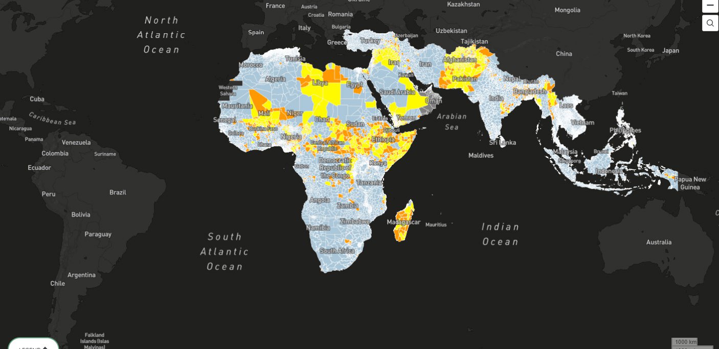
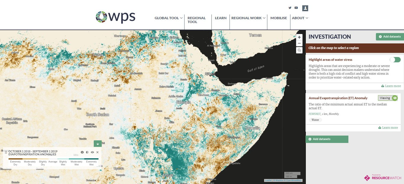
Local conditions and behaviors can link together in a long and complex causal sequence, where individual responses aggregate into larger consequences. For example, when hunger-weakened and unvaccinated livestock congregate, that may lead to mass outbreaks of disease, which can decimate herds and threaten local livelihoods. The tool enables the user to directly investigate the local conditions that are the key links in such causal chains. For example, annual evapotranspiration anomalies can capture deviations in typical vegetative or crop-growing activity, potentially providing an early indicator of poor grazing or scarce feed in the near future-and all that follows such scarcity.
Citations
- Woreda is the third-level administrative unit in Ethiopia, after region and zone.