Table of Contents
Precipitation (Gilo Village)
Another way to answer questions about the role of water in conflict is more qualitative, involving the sort of personal observations the WPS and New America teams collected in our visit to the region.
In that visit, we traveled approximately 30 kilometers southeast of Jigjiga to a clutch of modest structures clustered along the main highway: Gilo village. Gilo is in a rural area where the preeminent livelihood is animal husbandry, and we continually saw camels, goats, donkeys, and small cattle being herded along the major roadways and through Gilo itself. Commingled with the fixed buildings were collapsible structures of lightweight, lashed frames covered with textiles, testaments to the nomadic tradition still alive in the region.
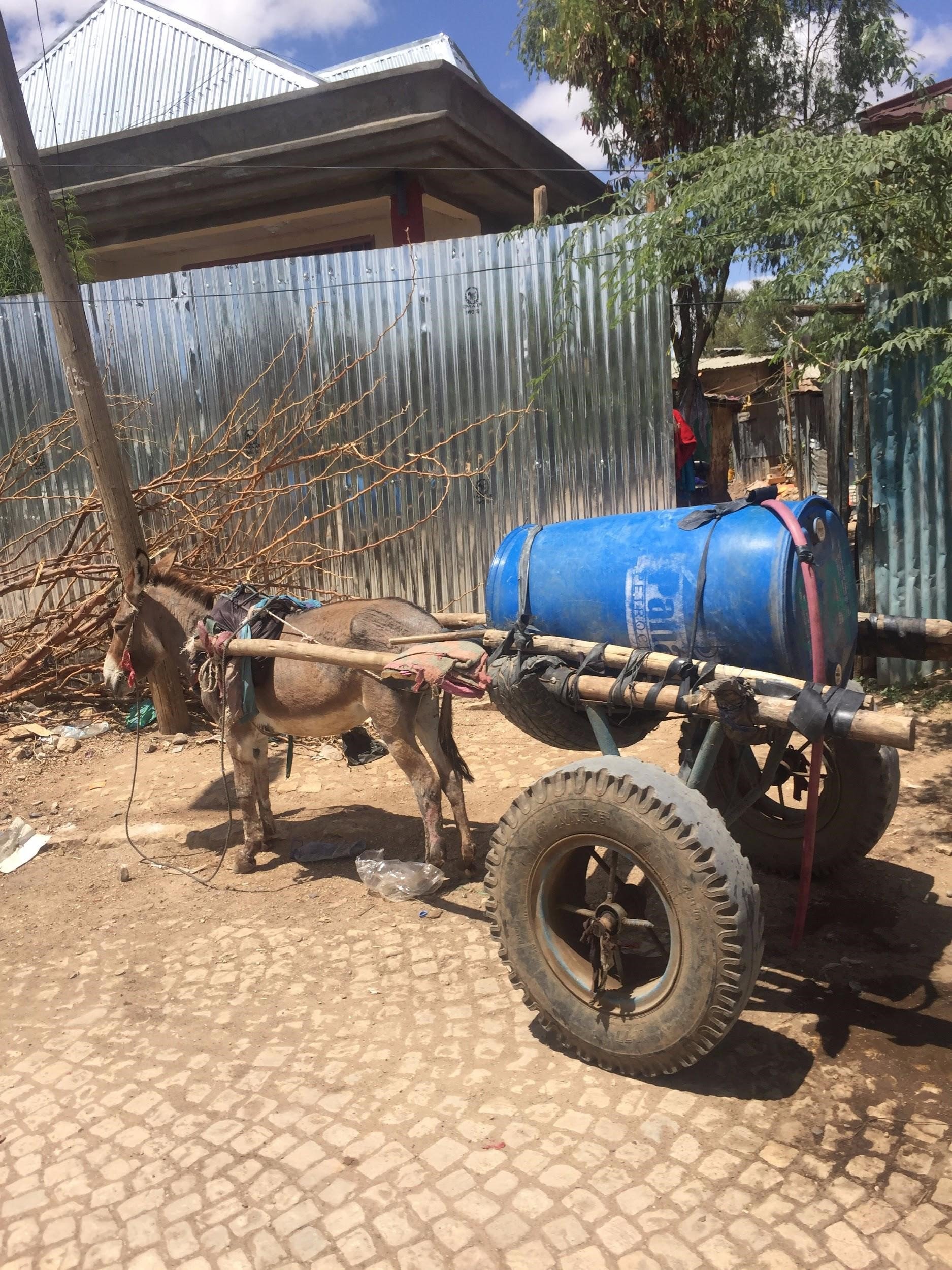
In Jigjiga, drinking and cooking water for many people is sourced from a modest man-made reservoir on the outskirts of the city. The water is pumped by diesel generators into small tanker trucks, driven into town, and delivered door to door by two-wheeled donkey carts. It is neither treated nor clean, but it is seemingly available.
Sharon Burke
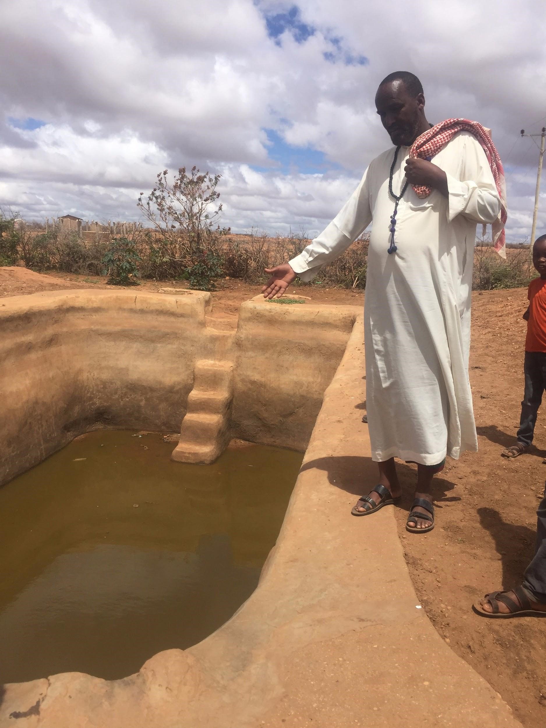
In contrast, Gilo village is exclusively dependent on birkads for water. A birkad is an open, rain-fed cistern, which may be earthen or lined with cement. Villagers rely on the semiannual rains to fill all of the cisterns, and then have to conserve that supply for up to half a year—or longer if a rainy season fails to replenish the supply. Because the water is stored in the open, its quality deteriorates continuously. After weak rains in April of this year, the birkads in Gilo were already mostly empty by late May, and the water that remained was green and opaque. Local residents told us that the water was making their children sick.
Sharon Burke
The impact of these supply challenges is compounded by the broad importance of water. Mohammed Abdul Hasan, head of the Gilo Rangeland Council, ticked off the critical roles of water in his community: human consumption, sanitation, animal consumption, growing crops for food and income, growing crops for animal feed, and watering livestock for food and income. And as he pointed out, agriculture in the area is typically rain-fed: "There is no familiarity with irrigation here."
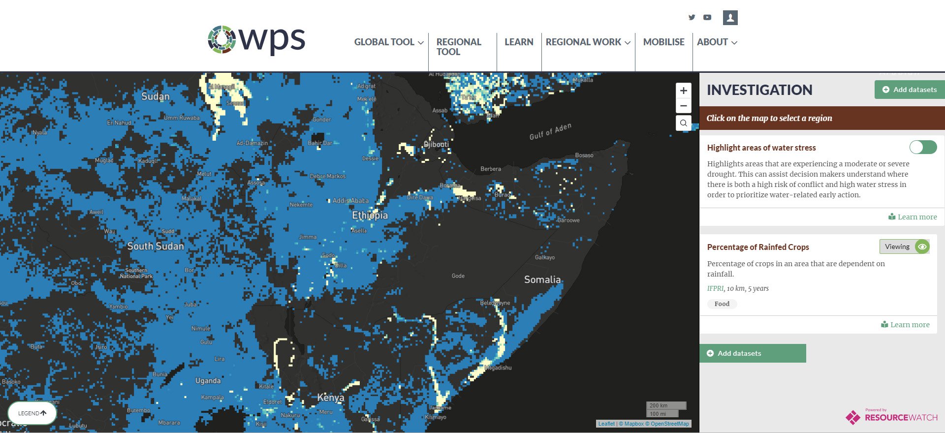
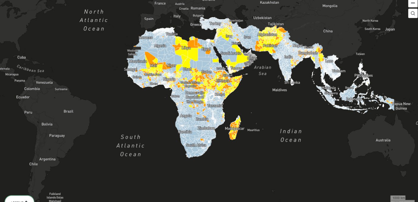
Rainfall represents a single failure point, but with consequences spilling downward along a number of possible pathways. The tool opens a window onto some of these pathways, allowing users to see where the risk exposures are greatest, as well as where threats, such as drought, are most acute. This enables rapid risk assessment as well as a means of evaluating and understanding possible conflict drivers.
For example, the prevalence of rain-fed agriculture leaves farmers at the mercy of the weather, exposing them to the risk of lack of food, feed, and income. The tool offers users a view to both sides of this equation: where crops are reliant on rainfall, and where rainfall patterns are deviating from historical norms.
Our visit to the region also highlighted the challenge of localization for a tool like this. The Gilo Rangeland Council told us that a pipeline was supposed to run through their area but that communities on the route had been cutting the pipe in the belief that such a pipeline on their land would reduce the availability of their own water. At the same time, members of the council suggested that there was not a positive relationship between drought and conflict; local families —all one clan—were more likely to cooperate in times of adversity, they told us, and argue in times of plenty.