Torrents of Water and Trickles of Data
Emergency Management, Data, and Critical Infrastructure
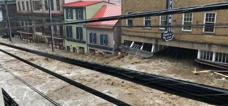
This past May, stormwater raced down Main Street in Ellicott City, Maryland, trapping individuals in buildings and destroying shops all through the historic town’s commercial hub. It was the second “thousand year flood” to ravage the city in the span of only two years — indeed, many of those small businesses were still recovering from the 2016 storm. This double occurrence was not just a bout of bad luck, as the Howard County Executive claimed. Instead, meteorologists have stated it is likely the changing climate played a role in the irregular frequency and intensity of rainfall that caused the catastrophic flash floods.
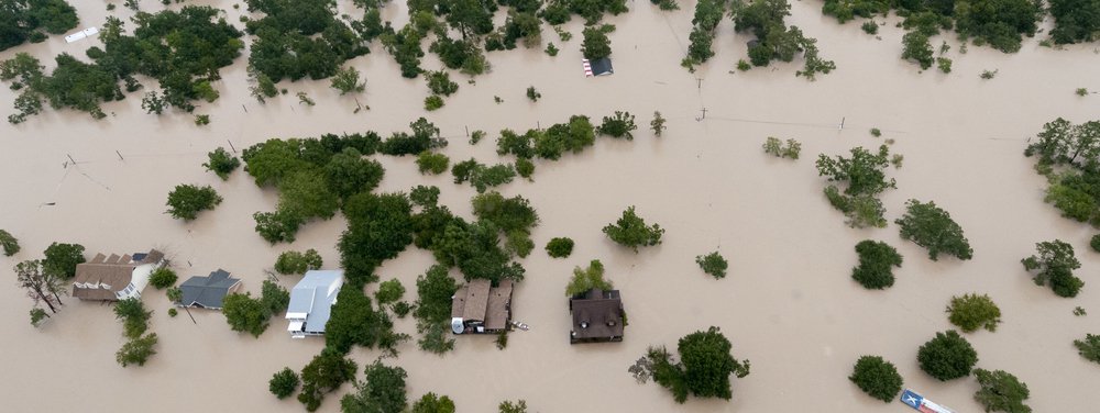
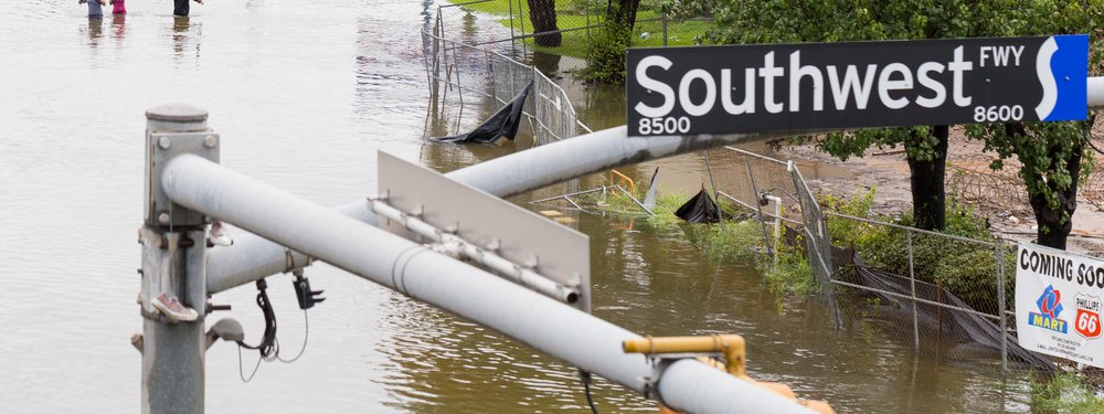
The floods in Ellicott City are just one local example of climate change’s effect on a slew of U.S. disasters that have occurred over the past year, from the destructive wildfires in California to the devastating hurricanes in the Southeast. For the foreseeable future, America is set to face an increase in severe weather events like these, and government officials, the fire and emergency services, police, voluntary organizations, and other first responders need to be ready for the rise in disasters. One way to do this is to ensure those responding to disasters are well informed with up-to-date, relevant information.
When a disaster happens, there is information everywhere — about where the damage is, what structures or systems are damaged, where the electricity is out, where there are still dangerous conditions, where there are risks to human safety, and so on. That great wealth of data, however, is not all in the same hands. In part, that’s because roughly 80% of all infrastructure in the United States is privately owned. So, emergency responders and local government officials may not have access to all the data they need in order to make good decisions about how to respond to a disaster to minimize the damage and protect human health and safety.
Data play an integral role in enhancing efforts to protect citizens during disasters, allowing emergency management practitioners—local and federal officials, as well as first responders, involved in emergency response efforts—to assess the impacts of a disaster within their jurisdiction. Through the collection and analysis of data, practitioners are able to identify areas that are especially vulnerable to disasters and then where the damage is worst when a disaster does occur, allowing first responders to help communities most in need first. Practitioners are already leveraging accessible data in an attempt to increase the nation’s resilience to natural disasters. However, what is currently missing from the field of emergency management is readily available private sector data regarding critical infrastructure, and that hinders disaster response efforts.
The Department of Homeland Security defines “critical infrastructure” as assets that if incapacitated would undermine U.S. national security, writ large. During a disaster, it is important for emergency management practitioners to assess the state of critical infrastructure, in particular, and prioritize restoration, as these assets are necessary to efficiently deploy resources and save lives. For example, water treatment facilities play a vital role not only in supplying drinking water to the public, but also in the operations of facilities such as hospitals. Damage to water treatment facilities during a disaster could have catastrophic cascading impacts, ultimately leaving hospitals without the sanitized water necessary for these facilities to function. In addition to putting human health at risk, such a challenge might divert the attention of emergency responders, forcing them to focus on lifesaving services rather than disaster response.
While critical infrastructure such as water treatment or the electric grid, provides essential public resources and services, it can still be privately owned, and the asset owners get to decide their level of engagement with first responders. There are ways for the private sector to work with first responders and other government agencies during emergencies, through groups such as Emergency Support Functions (ESF’s). However, private sector representatives are not obligated to share data, even in such groups. Thus, as the Geographic Information & Technology Association (GITA) reports, emergency responders often lack data pertaining to local infrastructure, complicating disaster response.
Take, for example, the electric utility sector. Electricity is a fundamental requirement for the U.S. economy these days, and also for disaster response; it sustains necessary infrastructure such as medical and communications facilities during emergencies. Emergency management practitioners rely heavily on web-based Geographical Information System (GIS) power outage maps to understand the hazardous landscapes in which they must operate. Data represented on utility power outage maps are often vague representations of the number of customers affected and estimated times of restoration for particular areas, however. What’s more, these GIS tools do not include the location and status of critical infrastructure, such as power generation facilities and water treatment plants, making it difficult for emergency responders to compare impacts of a disaster across their jurisdiction and efficiently deploy resources.
Realizing the importance of critical infrastructure in disaster response efforts, federal agencies are attempting to develop information-sharing platforms for emergency responders. Prompted by the attacks of 9/11, the U.S. Department of Homeland Security’s (DHS) Homeland Security Infrastructure Program (HSIP) developed a geospatial dataset of unclassified imagery data, inclusive of critical infrastructure. HILFD (Homeland Infrastructure Foundation-Level Data) boasts 24 categories of infrastructure, spanning disparate sectors such as chemical manufacturing plants and public health facilities. The Federal Emergency Management Agency (FEMA) has also developed a geospatial tool called SAVER² (Situational Awareness Viewer for Emergency Response & Recovery) that streamlines the representation of data from multiple emergency management partners. SAVER² provides an overlay of data points from various sectors within a GIS mapping platform, with the hopes of positioning itself as a one stop shop for information services tailored to the needs of emergency management practitioners. While these federal efforts are no doubt welcome, the real efficacy of these platforms depends on the voluntary engagement of private entities. HILFD data sets, for example, do not include privately owned infrastructure.
In their attempt to build up our nation’s resilience to natural disasters fueled by climate change, federal agencies should focus on strengthening information sharing practices between disaster response practitioners and private firms that own and operate critical infrastructure. Establishing agreements on what data regarding critical infrastructure should be shared and for what purposes will give emergency responders better access to valuable information, leading to a United States that is more prepared for the climate-related threats to come.
The author just completed a Millennial Fellowship with New America. His contribution to the The Millennials Initiative 2018, from which this piece was adapted, can be found at Millennials Initiative.
More About the Authors
Issues
Programs/Projects/Initiatives
Topics
Related
Dutch Flood Experts Come to Help Protect Galveston
How Texas Is Trying to Pioneer a Disaster Preparedness Path

For Boston Climate Resilience, It’s Full Steam Ahead